 |
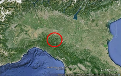
| North Italy, indicating general location of site in the Apennine foothills south of the Po plains (Prov. Piacenza) |
A mosaic of small meadows and arable fields bordered by hedgerows and copses extends from lower levels close to the river up to around 700m, sometimes on remarkably steep slopes, and sometimes to higher elevation. Deciduous woodland covers the higher ground and is slowly reclaiming many upper fields as these fall out of regular use.
The woodland (primarily Beech Fagus sylvatica with Oak Quercus spp., also Hornbeam Carpinus betulus, Hop-hornbeam Ostrya carpinifolia and others) is managed at artisanal level for fuelwood production on a system similar to 'coppice with standards' in Britain. Only small areas are harvested in any one year, in patches often much less than one hectare, and the rotation period is typically at least 20 years. This type of woodland use means that very large and old individual trees are infrequent, and that ascending trunks tend to be numerous and close together, for human observers limiting movement and visibility.
No comments:
Post a Comment